The Arcadia Pier
Next | Previous | Return to Start
|
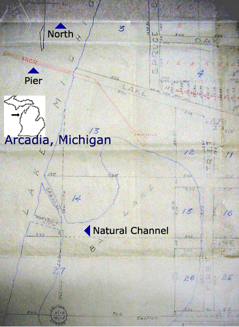
Before the channel was open, Arcadia's harbor was a pier in Lake Michigan originating from the end of Lake Street. |
|
|
|
|
|
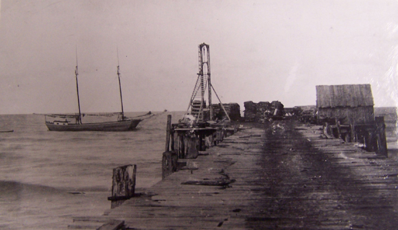
In 1880, Henry A. Starke of Milwaukee, who had purchased a tract of timber land surrounding Bar Lake, began to develop his property. He began construction on a 130 ft. bridge pier in Lake Michigan at the end of Lake Street. The pier would eventually extend about 1,000 feet into Lake Michigan and include railway tracks to handle heavy loads. In bad weather, the Arcadia harbor was safer than an exposed pier, but the natural channel at the north end of Bar Lake was often unusable. From time to time the natural channel was closed by shifting sand or so shallow only rowboats or small fishing boats could use it. |
|
|
|
|
|
The bridge pier was in use from 1881 through 1893 to ship products of the Starke sawmill, wood, bark, farm products, and anything else anyone shipped to or from Arcadia. In 1893, when the channel between Lake Michigan and Bar Lake was completed, the new safer harbor was available reliably to larger ships, and the pier was no longer needed. |
|
|
|
|