The Railroad's Route through Manistee County
Next | Previous | Return to Start
|
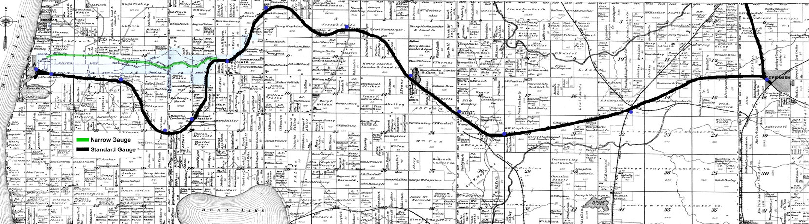
1903 strip of Manistee County townships
Green Line: The narrow gauge railway's discontinued route. In service 1881-1893.
Black Line: Standard Gauge Railway's route by December 1896.
|
Building the Railway
In 1881, construction began on Arcadia's narrow gauge railroad that ran east from Arcadia to a stop called Malcolm, a trip of about 5 miles.
|
|
|
In September of 1895, the standard gauge Arcadia & Betsey River Railway ran east from Arcadia 6.7 miles to Malcolm and then another 10.6 miles to Henry, where the A&BRR connected with the Chicago and West Michigan Railway. This railway would eventually merge into the Pere Marquette Railroad, the name shown in the map.
In December of 1896, the railway reached Copemish 21 miles from Arcadia, where it connected with the Ann Arbor Railroad.
|

The Early Narrow Gauge Railway
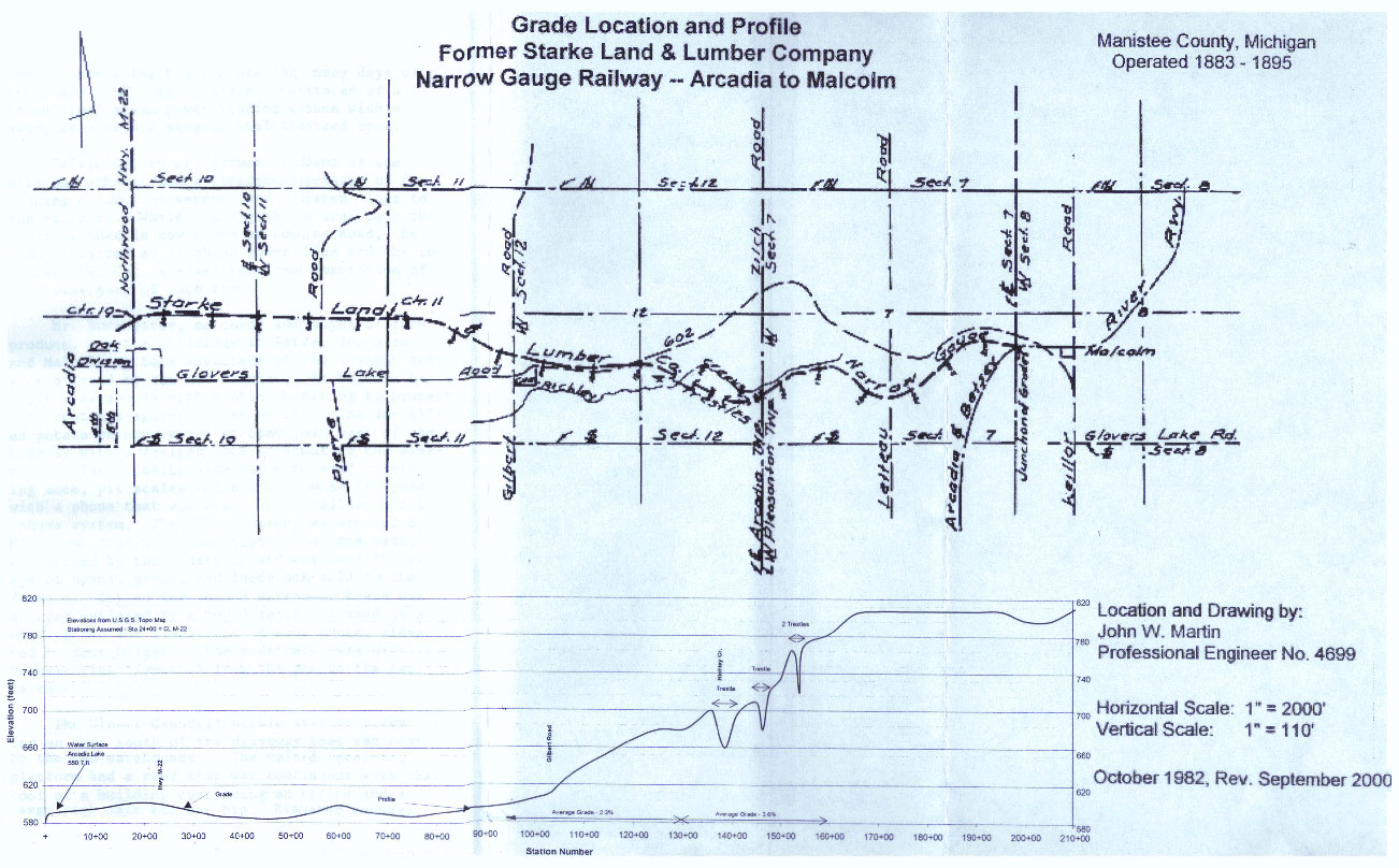
This map shows the route of the narrow gauge railway from Arcadia on the left to Malcolm on the right. Note the location of the trestle in the middle. (Click here to zoom in.) -- Map reprinted with permission of John W. Martin from his booklet, "Malcolm: A Station on the Arcadia and Betsey River Railway: Manistee County, Michigan"
|
|
|
Nearby Timber Lands and Claims
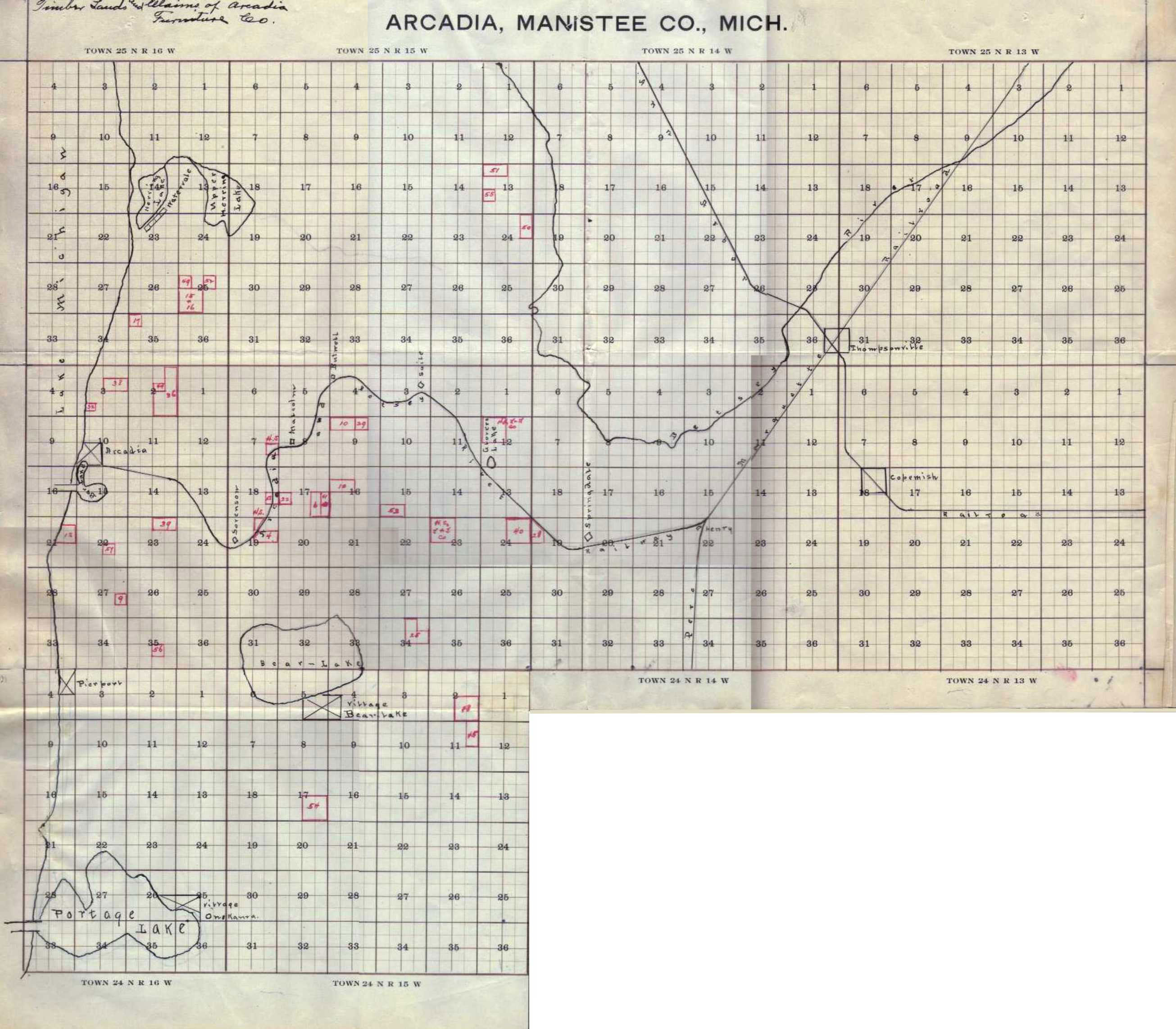
This is a drawing showing the Arcadia Furniture Company's timber holdings relative to the route of the standard gauge Arcadia & Betsey River Railway. -- Map courtesy of Ruth Starke Burkhead
|
|
|
Where the Railway Would Be Today
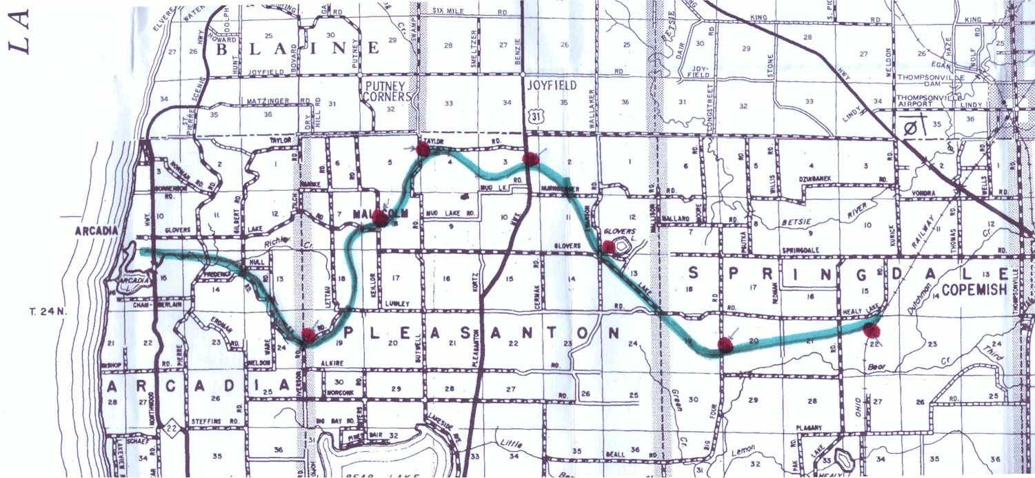
This map of Manistee County shows approximately where the standard gauge railway bed was. The red dots mark key stops between Arcadia and Henry.
|
Next | Previous | Return to Start